

Building a schema compliance tool for enterprise GIS
A practical look at using Python and ArcPy to validate feature class schemas against LGIM standards before data enters an enterprise GIS system.
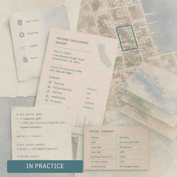
What happens behind the scenes of an automated hazard report
A simple report rarely starts with simple information. Before a property can be evaluated, scattered public records have to be found, cleaned, linked, queried, and translated into something clear enough to use.