

Where support may matter
Public data cannot tell the whole story of a place, but it can help show where support may matter.

Building a schema compliance tool for enterprise GIS
A practical look at using Python and ArcPy to validate feature class schemas against LGIM standards before data enters an enterprise GIS system.
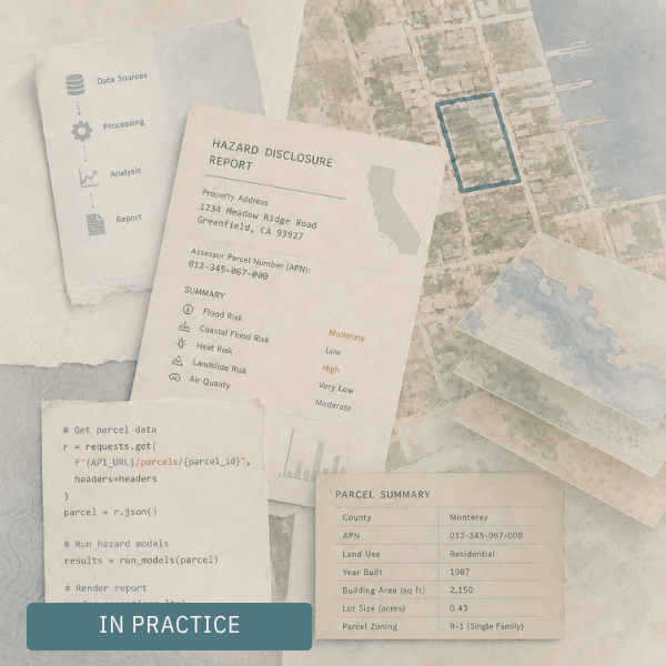
What happens behind the scenes of an automated hazard report
A simple report rarely starts with simple information. Before a property can be evaluated, scattered public records have to be found, cleaned, linked, queried, and translated into something clear enough to use.
Tracing exposure through everyday environments
Some conditions do not arrive as a single event. Air pollution, food access, infrastructure, and daily routines can make place part of the exposure itself.

Using neighborhood archetypes to understand unequal outcomes
Neighborhood data can make patterns visible, but it can also flatten them. Neighborhood archetypes offer a way to understand place as a combination of conditions, not a single variable on a map.
Linking healthcare data, public data, and place
This piece looks at research grounded in healthcare data, public health, and applied statistics, and shows how the underlying work carries far beyond healthcare. Across these studies, the real task was bringing together scattered forms of information to better understand patterns, place, and lived conditions.
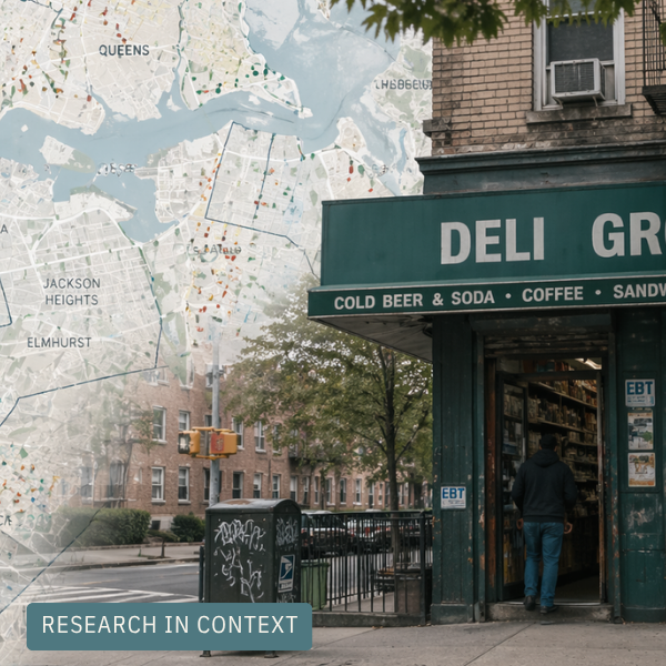
Building a usable food environment dataset for New York City
What began as a messy set of food outlet records became a way to describe neighborhood food exposure across New York City. That meant careful cleaning, classification, and geographic preparation before any analysis could begin.
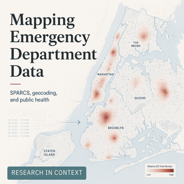
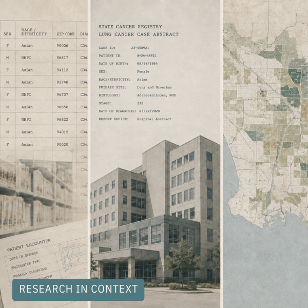
Turning emergency department data into public health insight
Before disease burden can be mapped across space and time, the underlying data has to be made usable. This post traces the geocoding and data preparation work that helped turn New York’s SPARCS emergency department records into a foundation for spatial public health research.