

Where support may matter
Public data cannot tell the whole story of a place, but it can help show where support may matter.
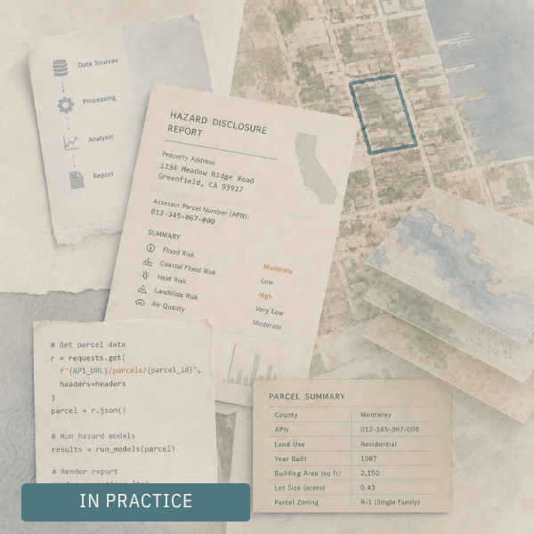
What happens behind the scenes of an automated hazard report
A simple report rarely starts with simple information. Before a property can be evaluated, scattered public records have to be found, cleaned, linked, queried, and translated into something clear enough to use.
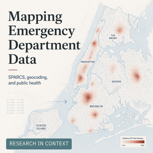
Turning emergency department data into public health insight
Before disease burden can be mapped across space and time, the underlying data has to be made usable. This post traces the geocoding and data preparation work that helped turn New York’s SPARCS emergency department records into a foundation for spatial public health research.