
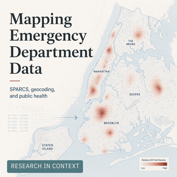
Turning emergency department data into public health insight
Before disease burden can be mapped across space and time, the underlying data has to be made usable. This post traces the geocoding and data preparation work that helped turn New York’s SPARCS emergency department records into a foundation for spatial public health research.